


On August 18, 1590, his granddaughter's third birthday, John White came back to the settlement on Roanoke Island and found no one there. Carved on a post inside the palisade was a single word, CROATOAN, with no cross and no sign of distress.
Listen to the episode: 50 States of Folklore - North Carolina: The Roanoke Colony’s Forgotten Curse
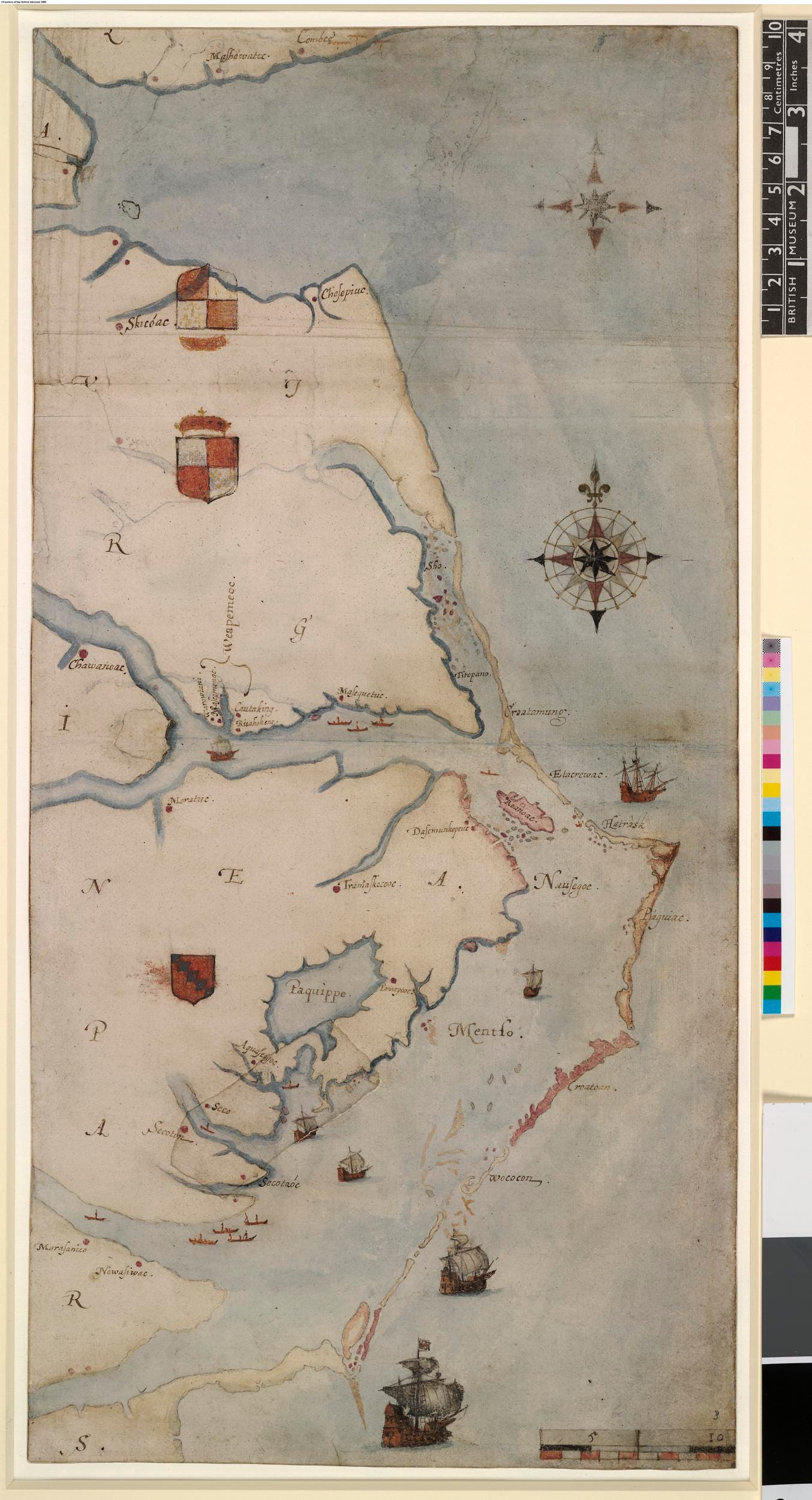
“La Virginea Pars,” John White’s map of the coast from Chesapeake Bay to Cape Lookout. A paper patch on this map hid the fort symbol found in 2012. British Museum 1906,0509.1.3, via Wikimedia Commons (public domain).
At a glance
In 1587 John White brought a colony to Roanoke Island. The National Park Service gives 117 or 118 people; NCpedia says about 150. [3][5][6]
White sailed home that August and did not return until 1590. He found “CROATOAN” carved on a post and no sign of distress. [2]
Croatoan was a place and a people: Manteo’s Carolina Algonquian community on what is now Hatteras Island. [5][9]
Digs have found English objects, none firmly tied to the colonists. [5]
1585 to 1587: the colony sets out
July 1585. White draws the Algonquian towns. On an earlier voyage, White drew the town of Pomeioc and its people, then Secotan. [10]
May 8, 1587. The colony leaves Plymouth. The plan was to go on to “the Bay of Chesepiok, where we intended to make our seate and forte.” [1]
July 22, 1587. Arrival at Hatorask. The fleet’s captain, Simon Fernandes, refused to take them farther, so they stayed on Roanoke Island. [1][3]
July 28, 1587. George Howe is killed. White wrote that Howe, one of the twelve Assistants, was slain. The people of Croatoan later said the attackers were “the remnant of Wingina his men” from Dasamonquepeuk. [1]
August 1587. A raid on the wrong people. An English reprisal struck people who had come “from Croatoan to gather the corne,” friends of the colony. The NPS says it “was only stopped by Manteo.” [1][3]
August 13, 1587. Manteo is christened. By Raleigh’s order he was christened on Roanoke and named its lord. [1][6]
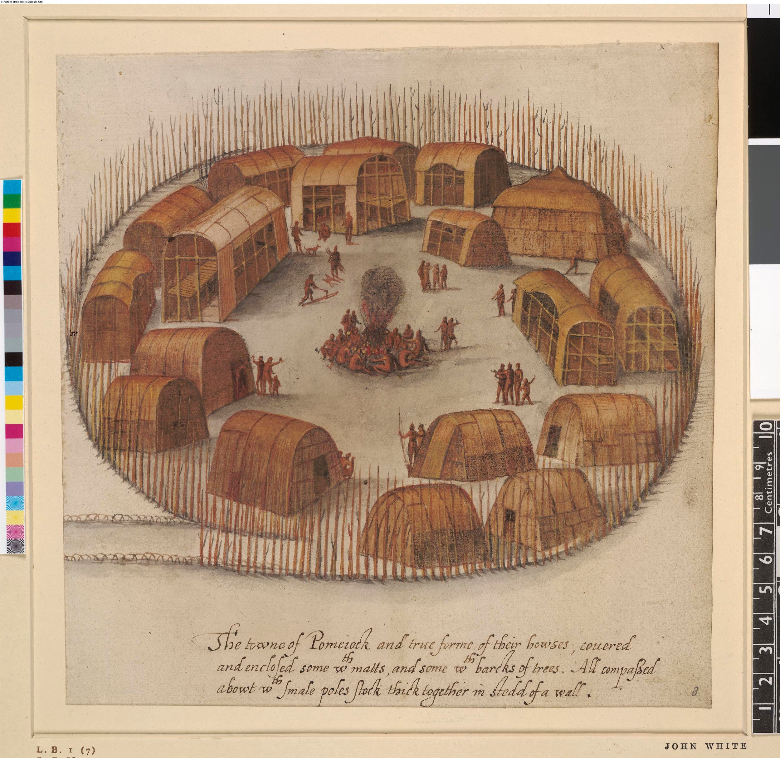
“The town of Pomeiooc,” a Carolina Algonquian town, in John White’s watercolour. British Museum 1906,0509.1.8, via Wikimedia Commons (public domain).
August 18, 1587. Virginia Dare is born. White’s daughter Elenor, wife of Ananias Dare, “was delivered of a daughter in Roanoak,” named Virginia as “the first Christian borne in Virginia.” She was christened August 24. [1][7]
August 27, 1587. White leaves. The colonists wrote that they had “incessantly requested” him to go to England for them. They meant “to remove 50 miles further up into the maine.” [1][3]
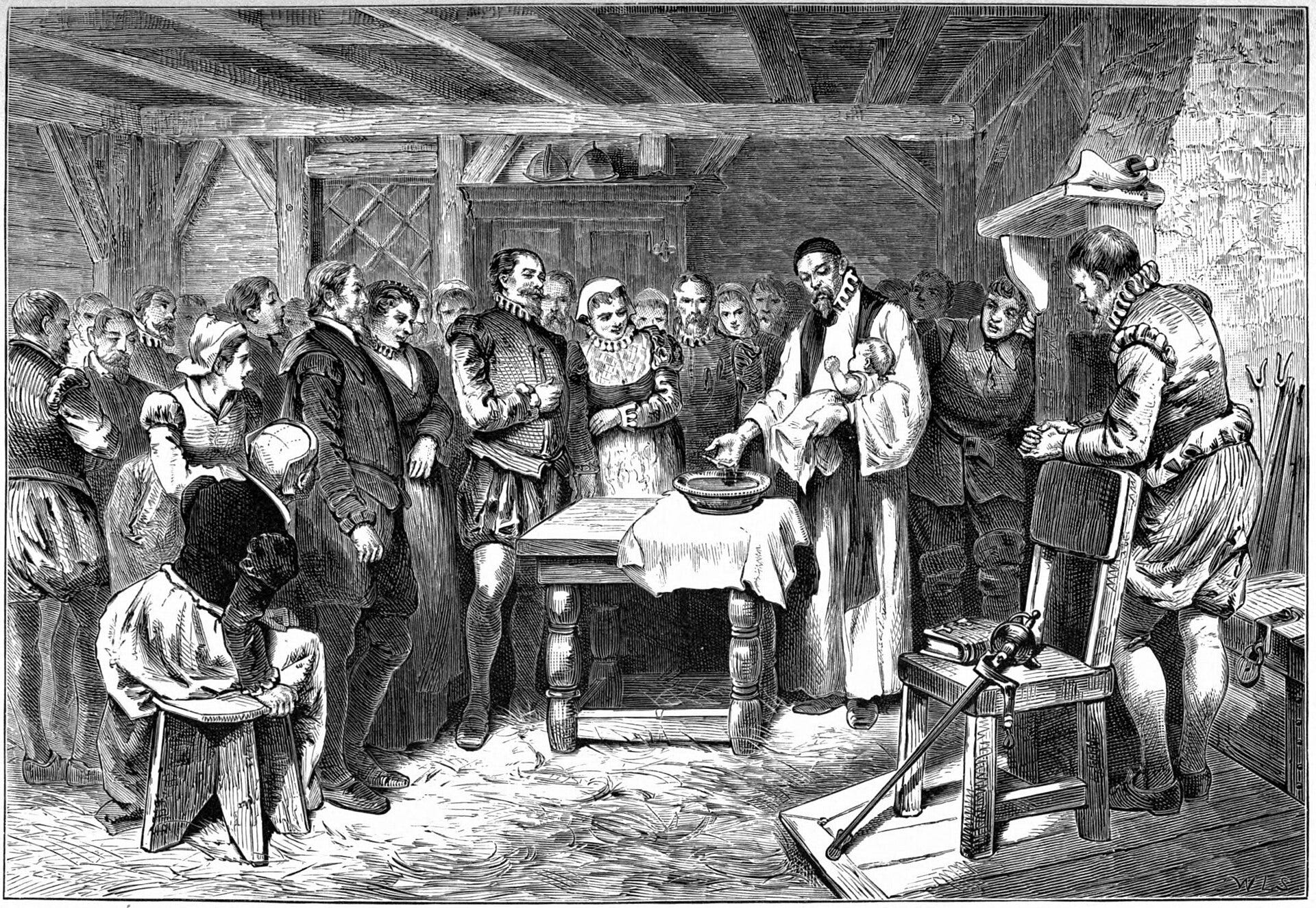
“Baptism of Virginia Dare,” an imagined scene by William Ludwell Sheppard, printed in 1876. Via Wikimedia Commons (public domain).
1588 to 1590: the return
1588. In the Armada year, White sailed with two small ships and 15 new settlers, but attacks at sea forced them home. [4][6]
March 7, 1589. A new agreement. Raleigh reached an agreement with White and London merchants to fund the effort. [6]
March 20, 1590. White sails again. He left Plymouth with the Hopewell, the John Evangelist and the Little John. [2]
August 15, 1590. Smoke. Anchored at Hatorask, they “saw a great smoke rise in the Ile Roanoak neere the place where I left our Colony.” [2]
August 17, 1590. Seven drowned. A boat overturned: “They were a 11 in all, & 7 of the chiefest were drowned.” That night the men saw a fire and sang “many familiar English tunes,” but “had no answere.” [2]
August 18, 1590. CRO and CROATOAN. It was Virginia Dare’s third birthday. [6] On a tree were “curiously carved these fair Romane letters C R O.” Inside “a high palisado of great trees,” on a post, was “graven CROATOAN without any crosse or signe of distresse.” His chests were dug up, his “bookes torne from the covers.” Still, he “greatly joyed” at this token of “their safe being at Croatoan, which is the place where Manteo was borne.” [2]
Late August 1590. No search of Croatoan. A storm left them “but one Cable and Anchor left us of foure.” The plan to sail to Croatoan was dropped. They reached Plymouth on October 24. [2]
About 1606. White dies. The NPS says he died, possibly in Ireland, around 1606. [4]
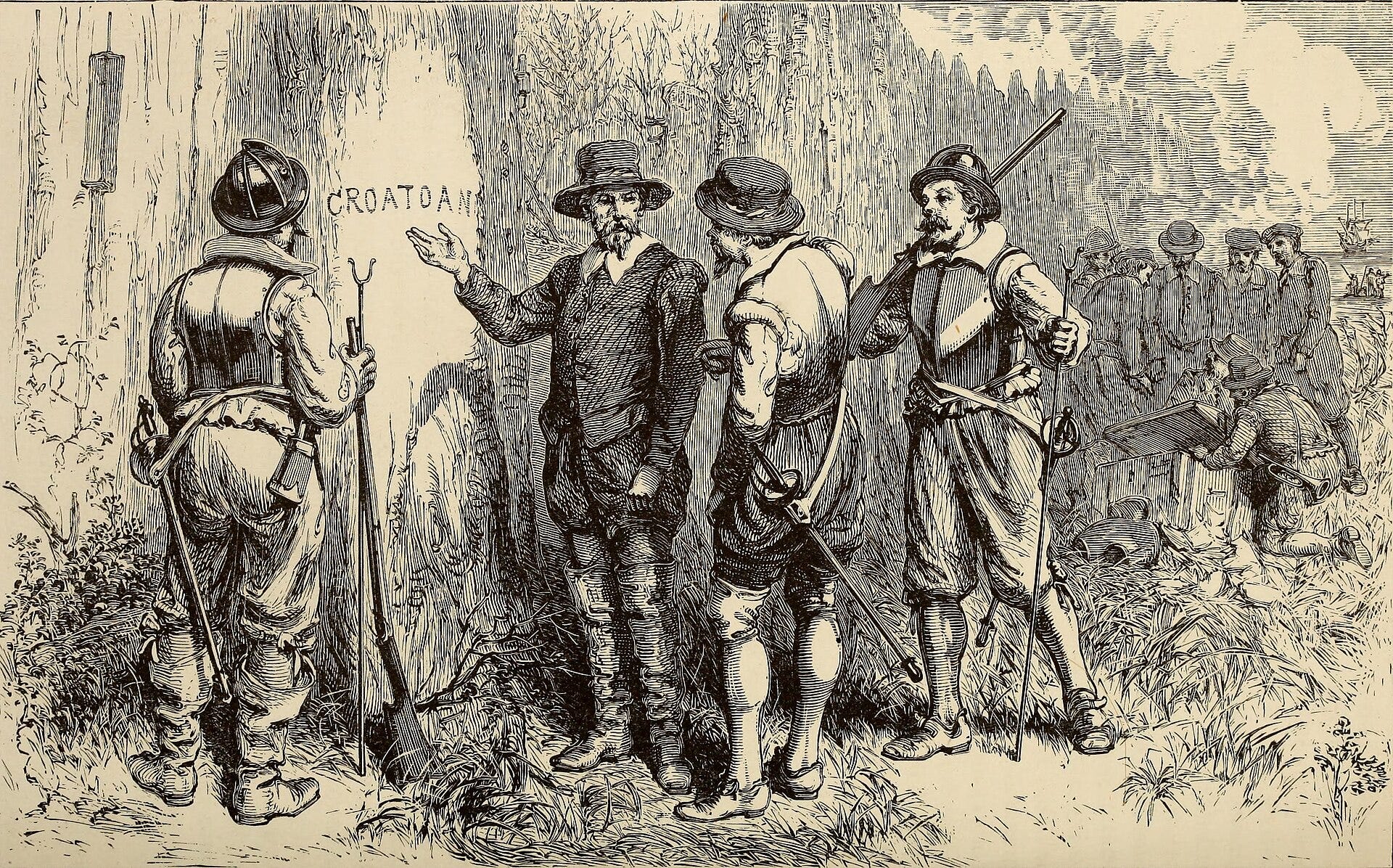
“CROATOAN, The Lost Colony,” an imagined 1876 scene of White’s return, designed by William Ludwell Sheppard and engraved by William James Linton. Via Wikimedia Commons (public domain).
What was tested
The map patches, 2012. After a First Colony Foundation inquiry, British Museum curators examined two paper patches on White’s map. Under one, where the Roanoke and Chowan rivers join Albemarle Sound, lay “a large ‘fort’ symbol in bright red and bright blue.” [11][12]
Site X and Site Y, from 2013. Foundation archaeologists led by Nick Luccketti found English pottery of the period in Bertie County. In 2015 the Foundation suggested only “a small group of survivors.” It now says Site X and a larger Site Y upriver were farms of the colony and that “The Lost Colony is Found!” The NPS says the artifacts “have not been definitively linked to the Lost Colony.” [5][12][18]
Cape Creek, Hatteras Island. Mark Horton of the University of Bristol and the Croatoan Archaeological Society reported a rapier handle, a writing slate and a Nuremberg counter. Horton said: “These are still just clues, we have no smoking-gun proof that the colonists survived into the 17th century.” National Geographic reported that many colleagues were skeptical. [13][14]
The Dare Stones, 1937 to 1941. Forty-eight stones purporting to carry the survivors’ messages surfaced from 1937 to 1940. On April 26, 1941, Boyden Sparkes called them a hoax in the Saturday Evening Post. NCpedia says most were faked, but the first, the Chowan River Stone, “has the potential to have been inscribed during the era of the colonists.” [15]
Theories and open questions
Croatoan. The carved word points to Hatteras Island. The NPS notes that objects found there may have come through trade, and that the island “may not have been able to support an additional 117 people.” [5]
Inland. The hidden fort and Site X fit the plan to move “50 miles” inland, but no graves or buildings have been found. [1][5]
Killed or absorbed. Jamestown colonists heard the Lost Colonists had died in a battle. Others propose that survivors joined Native communities; one theory names them among the ancestors of the Lumbee. [5][6]
Hurricane, drought, or Spain. The NPS lists these too, noting the buildings were taken down, not destroyed, and that Vicente Gonzalez sailed into the area in 1588. [5]
The “curse.” No source documents a curse. The episode frames it this way: “its curse seems to be how often we repeat the story without really hearing what it says about the foundations of this country.” [17] A later legend, retold by NCpedia, has Virginia Dare raised by Manteo’s people and turned into a white doe. [16]
Still unknown. The NPS says “no one has definitively proven what happened.” [5]
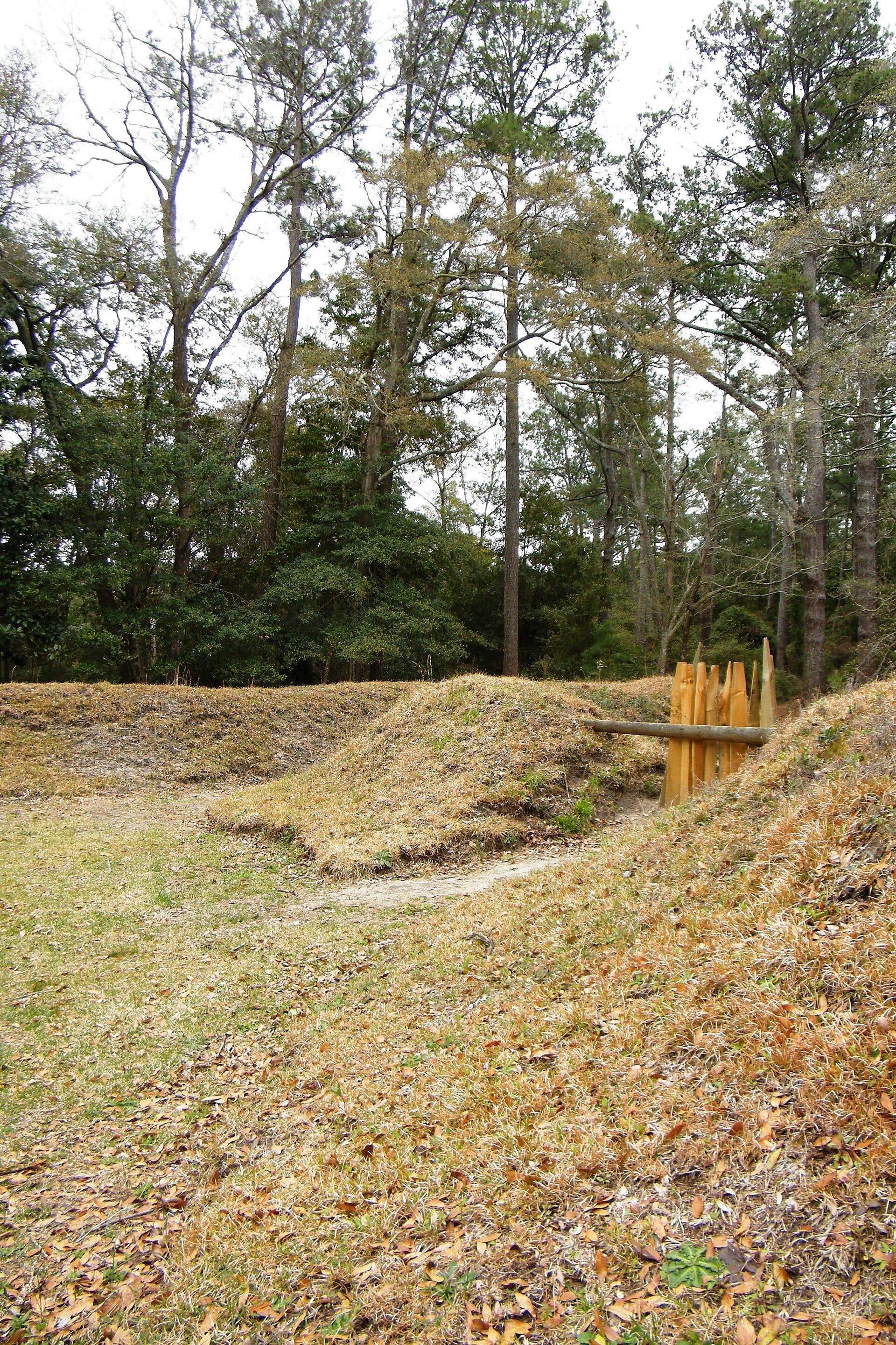
Reconstructed earthworks at Fort Raleigh National Historic Site, Roanoke Island. Photo by Sarah Stierch, 2011, via Wikimedia Commons (CC BY 4.0).
The places
Roanoke Island. The settlement site, now Fort Raleigh National Historic Site. [3]
Hatorask. Where the ships anchored in 1587 and 1590. [1][2]
Croatoan (Hatteras Island). Croatoan towns stood between today’s Buxton and Hatteras, about 60 miles south. [8][9]
Dasamonquepeuk. The mainland town of Wingina’s people. [1]
Site X, Bertie County. Near the hidden fort symbol. [12]
Near Edenton. Where the first Dare Stone was said to be found. [15]
Questions
What did White find? Houses taken down, a palisade, “CRO” on a tree, “CROATOAN” on a post, no cross. [2]
Was Croatoan a place or a people? Both. The Croatoan, later called the Hatteras Indians, were Carolina Algonquians. [9]
Did White ever go to Croatoan? No. Storms and a broken cable ended the search. [2]
What happened to Virginia Dare? Nothing is recorded after 1587. The white doe story is legend. [7][16]
Have the colonists been found? No. [5]
Listen
The full story is in the episode: 50 States of Folklore - North Carolina: The Roanoke Colony’s Forgotten Curse
Sources
John White, “The fourth voyage made to Virginia with three ships, in the yere 1587,” in Richard Hakluyt, Principal Navigations (1600), Virtual Jamestown. https://www.virtualjamestown.org/exist/cocoon/jamestown/fha/J1018
John White, “The fift voyage of M. John White into the West Indies and parts of America called Virginia, in the yeere 1590,” in Hakluyt, Principal Navigations, Virtual Jamestown. https://www.virtualjamestown.org/exist/cocoon/jamestown/fha/J1019
National Park Service, Fort Raleigh NHS, “1587: The Lost Colony.” https://www.nps.gov/fora/learn/historyculture/1587-the-lost-colony.htm
National Park Service, Fort Raleigh NHS, “1590 Rescue Voyage.” https://www.nps.gov/fora/learn/historyculture/1590-rescue-voyage.htm
National Park Service, Fort Raleigh NHS, “Major Theories of the Lost Colony.” https://www.nps.gov/fora/learn/historyculture/major-theories-of-the-lost-colony.htm
Phillip W. Evans, “Lost Colony,” NCpedia (Encyclopedia of North Carolina, 2006). https://www.ncpedia.org/lost-colony
William S. Powell, “Dare, Virginia,” NCpedia (1986). https://www.ncpedia.org/biography/dare-virginia
Phillip W. Evans, “CROATOAN,” NCpedia (2006). https://www.ncpedia.org/croatoan
Phillip W. Evans, “Croatoan Indians,” NCpedia (2006). https://www.ncpedia.org/croatoan-indians
David B. Quinn, “White, John,” NCpedia (Dictionary of North Carolina Biography, 1996). https://www.ncpedia.org/biography/white-john
First Colony Foundation, “Hidden Images Revealed on Elizabethan Map of America.” https://www.firstcolonyfoundation.org/news/hidden-images-revealed-elizabethan-map-america/
First Colony Foundation, “Testing Continues at Site X” (2015). https://www.firstcolonyfoundation.org/news/testing-continues-site-x/
University of Bristol, news release on the Hatteras excavations (August 2015). https://bristol.ac.uk/news/2015/august/lost-colony.html
Andrew Lawler, “We Finally Have Clues to How the Lost Roanoke Colony Vanished,” National Geographic (August 2015). https://www.nationalgeographic.com/culture/article/150807-lost-colony-roanoke-hatteras-outer-banks-archaeology
“The Dare Stones,” NCpedia. https://www.ncpedia.org/dare-stones
Daniel W. Barefoot, “White Doe, Legend of,” NCpedia (2006, revised July 2023). https://www.ncpedia.org/white-doe-legend
Midnight Signals, “50 States of Folklore - North Carolina: The Roanoke Colony’s Forgotten Curse” (March 31, 2025). https://midnightsignals.net/p/50-states-of-folklore-north-carolina-9a4
First Colony Foundation, “The Lost Colony is Found! How We Did It.” https://www.firstcolonyfoundation.org/news/lost-colony-is-found/
Image credits
John White, “La Virginea Pars,” British Museum 1906,0509.1.3. Public domain. https://commons.wikimedia.org/wiki/File:John_White_-_La_Virginea_Pars,_map_of_the_E_coast_of_N_America_from_Chesapeake_bay_to_Cape_Lookout,_1906,0509.1.3.jpg
John White, “The town of Pomeiooc,” British Museum 1906,0509.1.8. Public domain. https://commons.wikimedia.org/wiki/File:John_White_-_The_town_of_Pomeiooc,_1906,0509.1.8.jpg
William Ludwell Sheppard, “Baptism of Virginia Dare,” in William A. Crafts, Pioneers in the Settlement of America (1876). Public domain. https://commons.wikimedia.org/wiki/File:Baptism_of_Virginia_Dare.jpeg
William Ludwell Sheppard (design) and William James Linton (engraving), “CROATOAN, The Lost Colony” (1876). Public domain (no known restrictions). https://commons.wikimedia.org/wiki/File:William_Ludwell_Sheppard_%26_William_James_Linton_-CROATOAN,_The_Lost_Colony(John_White).jpg
Sarah Stierch, “Fort Raleigh National Historic Site earthworks” (2011). CC BY 4.0. https://commons.wikimedia.org/wiki/File:Fort_Raleigh_National_Historic_Site_earthworks_-_Sarah_Stierch.jpg


